
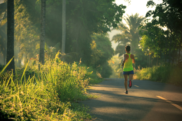
Marathons have already become a full-fledged part of the everyday life of many people. There is nothing better than feeling the track under your feet. Sometimes it relaxes and gives motivation and energy. Often, running helps to cope with physical problems and shortcomings, such as being overweight or having a slow metabolism.
We can say that running is a necessary procedure in these cases. When someone once tries to realize a marathon, he will never forget that pleasant feeling at the finish line. It doesn’t matter what motivation exists, what matters is that it exists. Today we present you the best routes where you can fully experience the blessings of the combination of sport and nature.
Milwaukee RiverWalk – Urban 1-2 miles
City center, city bustle along with your favorite hobby. Sounds attractive. The track connects three central coastal regions, passing through the Historic Third District, Center, and Beerline B. There are no sharp transitions here, one area seems to merge and smoothly merge into the neighboring one.
At this point, the Riverwalk has about 2 miles of distance. This figure is temporary, as work has been going on to improve the site for a long time. When completed, the Riverwalk will span over 3 miles, spanning both sides of the Milwaukee River.
It is quite real to get pleasure in the city center without interfering with passing cars and pedestrians. We must not forget about the incredible aroma of river biodiversity.
|
Milwaukee RiverWalk |
|
| Distance | Nearly 2 miles |
| Regions | Historic Third District, Center, and Beerline B |
| Start | Clayborn Street |
| Finish | Humboldt Avenue |
| Part areas |
|
| Type | Urban |
| Condition | Ongoing improvement efforts |
Washington Highlands – Urban/Nature
Washington Park is the perfect solution for those who don’t want to spend a lot of time getting out of the city. One mile to the park, one in the area, and one back. The total distance is about 3 miles. It is home to the Washington Center for Urban Ecology.
Near the Center, there is an old pond, where you can fully enjoy the natural beauty of the planet. The pond is the central element of the running track. An attractive hallmark of this track is its flexibility. The participant can make a choice in favor of his desires.
It is possible to run an additional distance in the park. Why is the site called urban/nature? Simply because the participants have the opportunity to enjoy both city views and magnificent natural landscapes. And all it is in the city center.
|
Washington Highlands |
|
| Distance | Nearly 3 miles |
| Regions | Washington Park, Urban Ecology Center |
| Start | W Lisbon Ave |
| Finish | Near main old pond |
| Type | Urban/Nature |
Milwaukee Lakefront Oak Leaf Trail
Oak Leaf Trail (Lakefront) – Citywide trail. The track has an incredible ecological history that will interest nature lovers. The total distance of the track is about 5 kilometers. The picturesque race runs along the water resources.
Participants get the opportunity to enjoy urban scenes at the same time as natural landscapes. Be prepared to meet a lot of office workers going out for lunch. Completely different pedestrians running about their business. And then abruptly – forest paths and lakes. Incredible transition.
| Oak Leaf Trail (Lakefront) | |
| Distance | About 5 kilometers |
| Regions | McKinley Park, Northpoint, Bradford Beach |
| Start | Veterans Park |
| Finish | Lake Park (Northpoint Lighthouse) |
| Type | Urban/Nature |
Hank Aaron State Trail
The state trail (Route of the Badger) is named after Hank Aaron, who died in 2021. Hank was the greatest baseball player ever. He has many records and achievements to his credit. One of which is the Milwaukee reusable runs.
For this reason, the city authorities decided to name the area after Hank. The trail today connects completely different regions of Greater Milwaukee. The area covers Lakeshore Bay right up to the forests.
| Hank Aaron State Trail | |
| Distance | 5-6 miles |
| Regions | Menomonee Valley, Historic Third Ward |
| Start | Rexnord Gear (Falk) |
| Finish | E. Michigan St., and N. Art Museum Dr. (Milwaukee) |
| Type | Urban |
| Category | Rail-Trail |
Bugline Trail – over 10 miles
A long landscape trail dotted with ravines, fields, and caves. The Bugline runs through Menomonee Falls and covers the surrounding area. The full trail is only 20 miles from Lake Milwaukee. The beginning of the route must be shared with pedestrians and tourists from residential areas.
yclists and joggers flock to the area from all over the city for recreation and sports. The start of the race begins in the residential area of Menomonee Falls. After the residential areas, the road goes into the forest regions. Oaks and lindens grow there.
The road also passes through a stone quarrying site – back in 1900, this place was famous.
| Bugline Trail | |
| Distance | 15.6 miles |
| Regions | Town of Lisbon, Menomonee Park, North Lake, Sussex |
| Start | Merton – Hartman Road |
| Finish | Menomonee Falls – Grand Avenue |
| Type | Urban/Nature |
| Surface | Asphalt |
Grant Park to Sheridan Park
To enjoy this track, you need to start from South Milwaukee. Wisconsin is rich in incredible landscape areas. The trail is shaped like a ring and has a total distance of 1.6 kilometers. The route is considered quite easy – a participant can overcome it in about 25 minutes.
Hiking, running, and cycling – all this can be done here. If you want privacy during the working day – make a choice in favor of Grant Park to Sheridan Park.
|
Grant Park to Sheridan Park |
|
| Distance | 1.6 kilometers |
| Regions | Grant, Sheridan Park, Cudahy, Howard Avenue |
| Start | Grant – South Milwaukee |
| Finish | Sheridan – Howard Avenue |
| Type | Urban/Lakefront |
| Route form | Loop |
Variable options – the choice is yours
Milwaukee provides runners with different options. Everyone will be able to get the desired pleasure and improve the necessary skills.
City or nature, tranquility or noise, independence or group – everything is available now.